HOT YLE英檢
Geospatial Technologies for Land Degradation Assessment and Management

Geospatial Technologies for Land Degradation Assessment and Management

  • 作者: Dwivedi, R. S.
  • 原文出版社:CRC Press
  • 出版日期:2018/10/18
  • 語言:英文
  • 定價:8525

分期價:(除不盡餘數於第一期收取) 分期說明

3期0利率每期28416期0利率每期1420
  • 運送方式:
  • 臺灣與離島
  • 海外
  • 可配送點:台灣、蘭嶼、綠島、澎湖、金門、馬祖
  • 可取貨點:台灣、蘭嶼、綠島、澎湖、金門、馬祖
載入中...

商品公告訊息

POD商品訂購提醒

本書為訂購後印製(POD)之商品,將於購買後進貨,約需等待30-40天,建議您單獨下單,謝謝耐心等候。more

  • 分享
 

內容簡介

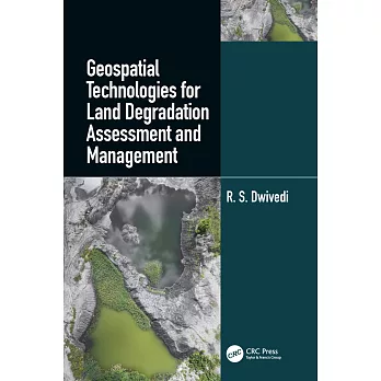
The constant growth of the world’s population and the decline of the availability of land and soil resources are global concerns for food security. Other concerns are the decrease in productivity and delivery of essential ecosystems services because of the decline of soil quality and health by a range of degradation processes. Key soil properties like soil bulk density, organic carbon concentration, plant available water capacity, infiltration rate, air porosity at field moisture capacity, and nutrient reserves, are crucial properties for soil functionality which refers to the capacity of soil to perform numerous functions. These functions are difficult to measure directly and are estimated through indices of soil quality and soil health. Soil degradation, its extent and severity, can also be estimated by assessing indices of soil quality and health.

"Geospatial Technology for Land Degradation Assessment and Management" uses satellite imagery and remote sensing technologies to measure landscape parameters and terrain attributes. Remote sensing and geospatial technologies are important tools in assessing the extent and the severity of land and soil degradation, their temporal changes, and geospatial distribution in a timely and cost-effective manner.

The knowledge presented in the book by Dr. R.S. Dwivedi shows how remote sensing data can be utilized for inventorying, assessing, and monitoring affected ecosystems and how this information can be integrated in the models of different local settings. Through many land degradations studies, land managers, researchers, and policymakers will find practical applications of geospatial technologies and future challenges. The information presented is also relevant to advancing the Sustainable Development Goals of the United Nations towards global food security.


作者簡介

Dr Ravi Shankar Dwivedi is a consultant and guest faculty at Jawaharlal Nehru Technological University Hyderabad, India. He is an expert Land resources management: Soil resources inventory, mapping and monitoring land degradation/ desertification, wastelands and land use/ land cover using a variety of remote sensing data. He has a long experience also in Watershed management- Generation of inputs especially soil resources, land capability and land irrigability maps, surface water bodies maps and drainage maps; integration of these maps with hydrogeoplogical maps and development of action plan, monitoring and impact assessment using multi-temporal satellite and ancillary data.He holds Awards from Indian Society of Remote Sensing for outstanding contribution in the field of remote sensing and Doreen Mashler Team Award for outstanding contribution to integrated watershed management for sustainable development (as a member of ICRISAT team).


詳細資料

  • ISBN:9781498749602
  • 規格:精裝 / 429頁 / 普通級
  • 出版地:英國
 

商品公告訊息

  • POD商品訂購提醒

    本書為訂購後印製(POD)之商品,將於購買後進貨,約需等待30-40天,建議您單獨下單,謝謝耐心等候。

最近瀏覽商品


相關活動

  • 【科普、電腦】高寶電子書暢銷書展:人生就是選擇的總和,全展75折起
 

購物說明

外文館商品版本:商品之書封,為出版社提供之樣本。實際出貨商品,以出版社所提供之現有版本為主。關於外文書裝訂、版本上的差異,請參考【外文書的小知識】。

調貨時間:無庫存之商品,在您完成訂單程序之後,將以空運的方式為您下單調貨。原則上約14~20個工作天可以取書(若有將延遲另行告知)。為了縮短等待的時間,建議您將外文書與其它商品分開下單,以獲得最快的取貨速度,但若是海外專案進口的外文商品,調貨時間約1~2個月。 

若您具有法人身份為常態性且大量購書者,或有特殊作業需求,建議您可洽詢「企業採購」。 

退換貨說明 

會員所購買的商品均享有到貨十天的猶豫期(含例假日)。退回之商品必須於猶豫期內寄回。 

辦理退換貨時,商品必須是全新狀態與完整包裝(請注意保持商品本體、配件、贈品、保證書、原廠包裝及所有附隨文件或資料的完整性,切勿缺漏任何配件或損毀原廠外盒)。退回商品無法回復原狀者,恐將影響退貨權益或需負擔部分費用。 

訂購本商品前請務必詳閱商品退換貨原則 

  • MP
  • 繪本展
  • PRHUS